





Warwickshire County Council commissioned the development of a new fire training facility on a former railway siding and storage yard.
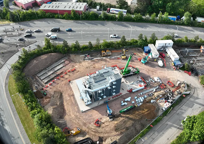
The brownfield site presented typical legacy issues: variable ground conditions, uneven terrain and a high likelihood of buried obstructions associated with historic industrial use.
To create a level construction platform, the project required significant remediation and earthworks, including cut and fill operations and the movement of imported and exported materials.
Engineering challenges
The project team needed to address several constraints common to brownfield redevelopment:
- Accurately quantifying cut and fill volumes across a complex site
- Identifying and managing buried obstructions from historic railway use
- Coordinating earthworks within a confined working area
- Maintaining reliable site information as ground levels changed rapidly
- Mapping existing infrastructure to support construction sequencing
These challenges made traditional surveying alone insufficient for the level of accuracy and frequency required.
Digital surveying approach
To support planning and ongoing decision making, the team adopted a digital-first approach.
Aerial drone surveying, combined with advanced modelling software, was used to provide accurate and up-to-date site intelligence throughout the project.
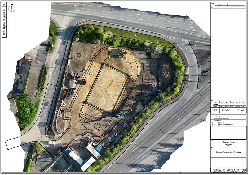
A pre construction drone survey established a baseline topographical model.
Weekly drone flights were then undertaken throughout the earthworks phase, allowing the team to monitor changes and adjust plans in near real time.
Key technical outputs
- 3D topographical modelling: digital terrain models provided detailed insight into existing levels and ongoing changes.
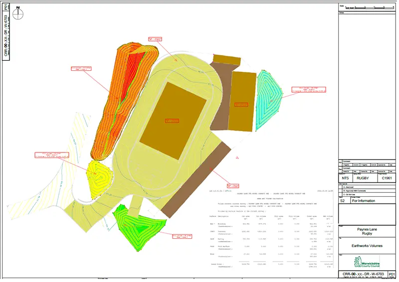
Site volume analysis. Image credit: Tregartha Civil Engineering. - Isopach mapping: cut and fill drawings and volume calculations supported material management and sequencing.
- 2D photogrammetry: high resolution imagery captured site conditions and helped map existing infrastructure.
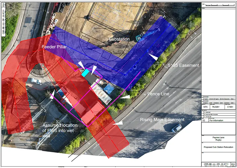
Drone survey with existing infrastructure showing critical asset easements. Image credit: Tregartha Civil Engineering. - Integrated data analysis: historic records were combined with survey outputs to identify potential obstructions early.
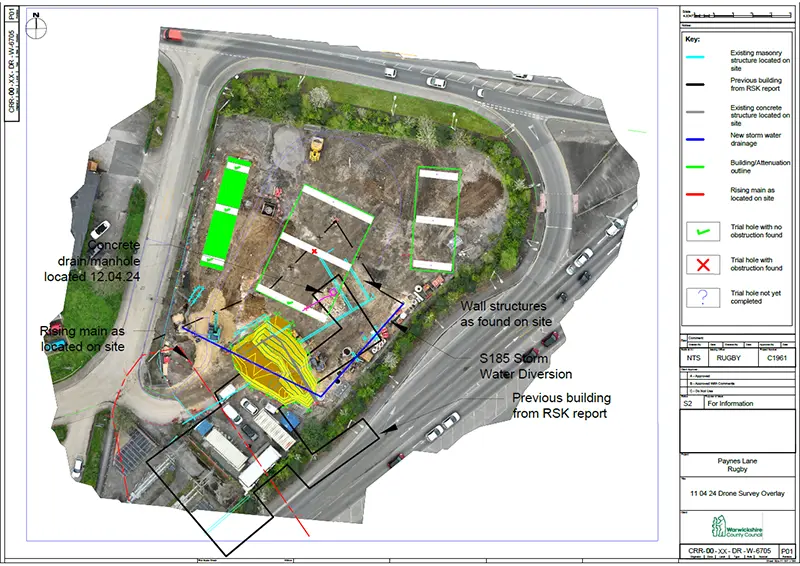
Drone overlay with historic records to trace hidden obstructions. Image credit: Tregartha Civil Engineering. - Progress monitoring: regular visual updates improved coordination between the client, contractor and design team.
Outcomes
The combined use of traditional surveying and drone based data capture gave the project team a clear understanding of site conditions throughout the works.
According to the project report, uncharted obstructions and existing infrastructure were identified and managed more effectively.
This approach supported:
- More predictable earthworks operations
- Reduced disruption from unexpected buried features
- Improved material management through accurate volumetric analysis
- Better communication between stakeholders through shared visual data
The digital workflow enabled the team to move from reactive problem solving to proactive planning, which is increasingly important in brownfield redevelopment.
Lessons learned
- Frequent digital surveys reduce uncertainty on sites where ground conditions change rapidly.
- Integrating historic records with modern survey data helps anticipate buried obstructions.
- Visual communication tools improve coordination between multidisciplinary teams.
- Drone based volumetrics can support more efficient material movement planning, especially on constrained sites.
Project details
- Project: Paynes Lane Fire Training Facility
- Owner: Warwickshire County Council
- Surveying and data: Tregartha Civil Engineering
- Location: Warwickshire, United Kingdom
- Year built: 2024


You may also be interested in

- Type
- ICE Community blog
What's the foundation of flood resilience? Information
ICE President David Porter explains why being informed about flood risk is so important for the public and civil and infrastructure engineers.

- Type
- Awards and competitions
It’s electrifying! South Wales Metro track transformation bags top award
The electrification of the Core Valley Lines impressed the judges at the 2026 British Construction and Infrastructure Awards.

- Type
- Civil Engineer blog
The long-term consequences of a really good idea
Good decisions made at speed can lead the industry down unintended paths, writes Steven Yule, ICE country representative for the UAE.